After four years of planning, brainstorming and meeting with community leaders, stakeholders and land-manager partners, the Sierra Buttes Trail Stewardship has released its draft Trails Master Plan detailing the components of its visionary Connected Communities project.
The 68-page master plan, which is still in the review process, outlines the steps to creating sustainable economies for Lost Sierra communities through tourism and new jobs stemming from outdoor recreation.
At the heart of the TMP is the creation of a 564-mile shared-use singletrack trail network connecting 15 towns, dubbed The Lost Sierra Route, that aims to serve the needs of all recreational trail users. It is primarily located in Northern California and includes most of Plumas, Sierra, Lassen, Butte and Nevada Counties, and connects into Washoe County, Nevada. To this end, the TMP includes a Trails Feasibility Study (see Appendix 2 below) and a cost estimate (Appendix 8 below).
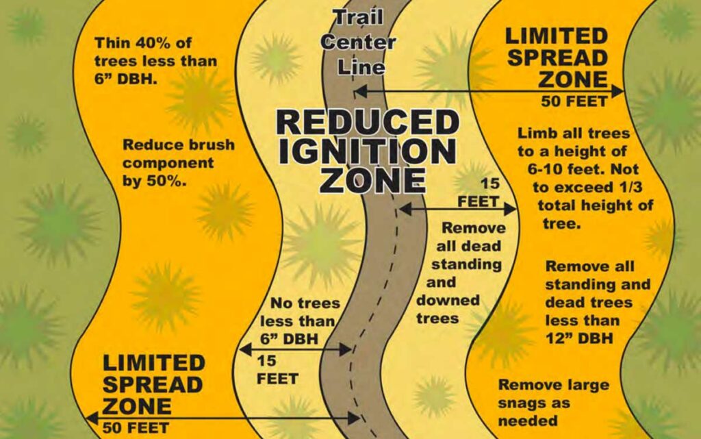
Graphic of Fire Hardened Trails. In Appendix 7.
Other components of the TMP includes suggestions for capital improvement projects, like trailheads and educational signs, to support the Lost Sierra Route, highlighting Recreation Zones as areas near communities that potentially warrant additional trail and infrastructure planning and development and addressing fuels reduction and forest restoration through a Fire-Hardened Trail Prescription for vegetation management corridors.
Publishing the draft Trails Master Plan marks a major milestone in the Connected Communities project, which started as an idea SBTS’ executive director Greg Williams first presented at a trails conference at Mammoth Mountain in 2019. With support from the Sierra Nevada Conservancy and Proposition 68 funding, SBTS was able to start the planning process the following year, conducting community outreach and engagement in the proposed Connected Communities footprint, collaborating with land managers, tribes and local organizations and evaluating route feasibility through GIS mapping and field groundtruthing.
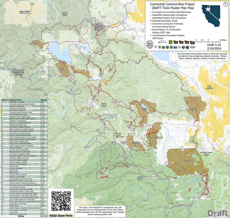
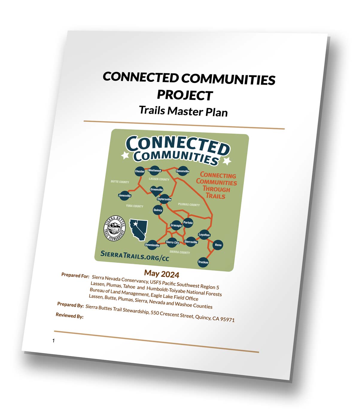
Connected Communities Project Maps, Appendix 1
“Connected Communities stems from a desire to use trails as a tool to ensure economic stability in the Lost Sierra, a region whose communities have historically been subject to the boom and bust nature of resource extraction industries, causing locals to leave to seek employment in other areas. But the ultimate goal is for the Trails Master Plan to transcend this region, and become a model for communities around the country, and even globally, to develop their own economic empowerment and sustainable development,” Williams said.
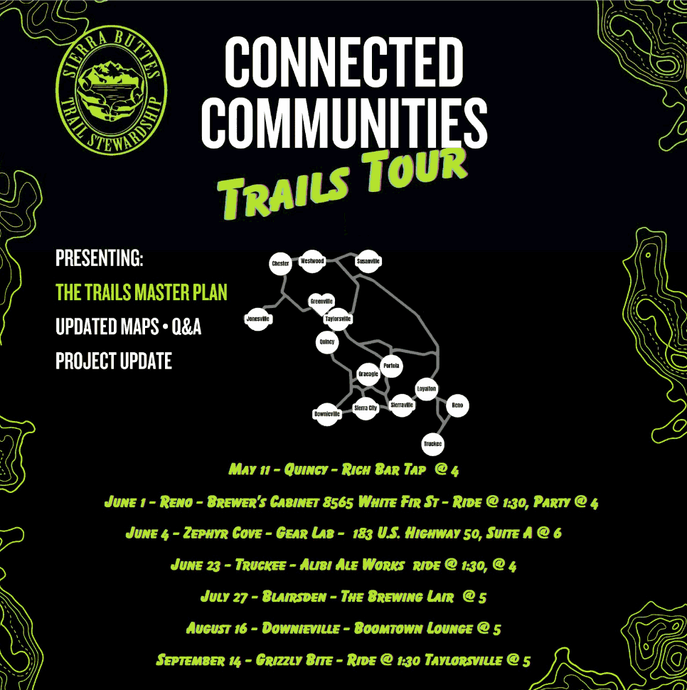
The TMP is still a draft, and SBTS has submitted it to U.S. Forest Service Pacific Southwest Region 5, Tahoe, Lassen, Plumas and Humboldt Toiyabe National Forests for input, as well as the local cities and counties involved. We’re also taking the Plan on tour with dates scheduled through September, to get community input and answer any questions—please join us at one of the stops below! You can also email feedback to info@sierratrails.org