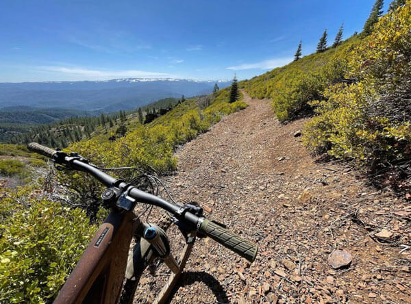
The Dixie Fire is nearly contained thanks to the amazing work of fire fighters, forestry technicians and support personnel and our recent, much-needed rains! Blue skies are back and the forest is officially open which means Downieville, Lakes Basin, Mills Peak and other lands not in the fire’s path are ready for outdoor adventure. We are extremely excited to get back into our forests and public lands. Yet, fire season is still in full swing and the dangers are still high. Follow forest restrictions and use your best judgment and be cautious and careful while out enjoying nature.
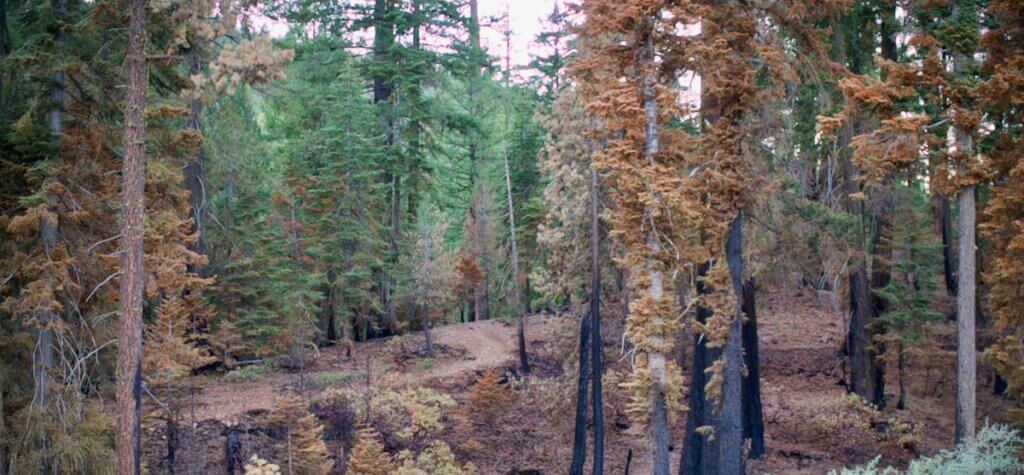
For the burned areas, it is uncertain when trails there will be opened again including Mount Hough in Quincy and any other areas in the burn scar. We are anxious to get back out to rebuild trails, and it’s going to take a little time to get there. The timing will vary depending on weather and activities, and we do not expect to be working on fire-damaged trails until Spring 2022.
![]() The USFS recently issued the following guidance regarding getting back out in the woods to repair the damage:
The USFS recently issued the following guidance regarding getting back out in the woods to repair the damage:
-
Fire fighters are actively patrolling areas and when they encounter the public, they must escort those individuals out of the active fire area which hampers their ability to complete fire mop up activities and patrols for new flare ups.
-
Fires can burn at over 2000 degrees Fahrenheit and even though areas appear to be “out” the fire may burn underground through stumps and root systems for months. Areas that burn become unpredictable with unseen hazards and changed conditions for months and in some cases years after wildfire and even more so in areas of high burn intensity.
-
The land and resources are highly vulnerable after wildfire. Allowing time for the forest to stabilize and recover is needed for public safety and for the forest ecology to become more resilient.
-
The US Forest Service is working on initial assessments and suppression repair plans to begin re-establishing trails and roads that were affected by dozer lines. Before volunteers can begin assisting with repairs, hazard tree felling and suppression repair must be completed. Work in areas that are outside of the fire perimeter may begin sooner to repair contingency dozer lines that impacted trails. The area really needs more moisture before tread work can commence.
-
There are many trees that are now unstable that pose an imminent hazard until those trees may be safely felled. This will take time and some trails may be closed for a longer duration than the immediate fire response.
-
Soils are affected by fire and can become vitrified. Soils can become hydrophobic and repel rainfall and moisture for 1 to 2 years. Soil can “fluff up” or have a hard crust at the surface and in some areas trail and trail benches have become indistinguishable from the surrounding landscape.
-
Due to the void of vegetation and strong root systems and combined with hydrophobic soils; erosion and runoff can be expected to increase.
-
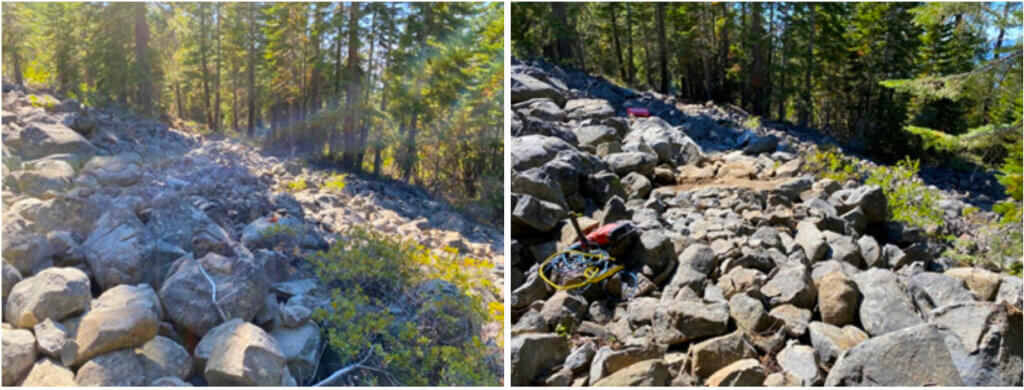
In areas where dozer lines were established, all trail control points have been erased. These areas will be very challenging to reestablish trails due to the lack of vegetation, logs, trees, boulders and other control points that would normally define the trail. Moving forward we will need to work together to preserve soils, re-establish sustainable trail alignments and allow for revegetation to occur, particularly in areas that have extensive dozer lines. Trail establishment will include restoring the dozer line to define the trail by strategically placing logs, rocks and other native material to define the trail and promote drainage. Assistance will be needed to block fall line dozer lines to prevent continued erosion from recreation access.
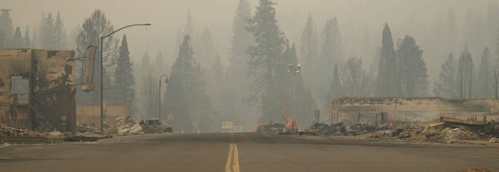
Greenville, one of the small mountain towns that’s a part of our Connected Communities Project and an important piece of the Lost Sierra Route featured in the A Trail for Everyone film, will remain a priority for us. We believe we can help this town rebuild, breathing new life into the heart of the community while honoring the history and generations of families who lived there. We will provide a space for community members to connect with the land and help them heal. A space where visitors will return to bring recreational tourism dollars back into the pockets of the community. A place where all trail users can explore nature, learn about Stewardship, go outside, play and have fun.
As we wait to get back into restoring trails, we are still working on bringing new trails to the Lost Sierra. During the Dixie Fire, our Pro Trail Crew was still able to keep working in non-burning areas. We worked closely with the USFS Tahoe and Plumas National Forests to obtain permits and continue our project maintenance. We also received permission to continue on the Beckwourth Peak Trail and completed 4.25 miles of new trail construction for that 20-mile project. We are even having a trail day event this Saturday, September 25 in honor of National Public Lands Day on Beckwourth Peak Trail – click here to RSVP.
We are continuing on our path to help revitalize economies through recreation and while protecting our communities with trails, which help create natural fire breaks that assist in combating wildfires. And now more than ever, our path is clear in continuing to move the Connected Communities Project forward and create the Lost Sierra Route.