Sierra Buttes Trail Stewardship (SBTS) has applied for four project grants this year and need your comments to CA-OHV on both so we can receive the grants and continue providing #dirtmagic to the public! Below are instructions in an easy, step-by-step process and the link to submit your comments in support of SBTS receiving these grants.
As far as what to say, you can be brief or you can pontificate, but the crux is to communicate how important the Downieville and Quincy trails are to you and how important it is to keep these trails open for the public to use. Also mention the economic importance of the trails, for they provide critically positive economic impact in two struggling California counties.
Ideas on why to comment:
- Recreation opportunities for visitors and locals
- Creates local employment
- Creates sustainable trail systems that require less maintenance
- Keeps trails open and safe while protecting watershed
The comment period closes May 4, so please provide comments before then, and spread the word! The more positive comments we receive, the better.
How to comment in 3 easy steps and details below
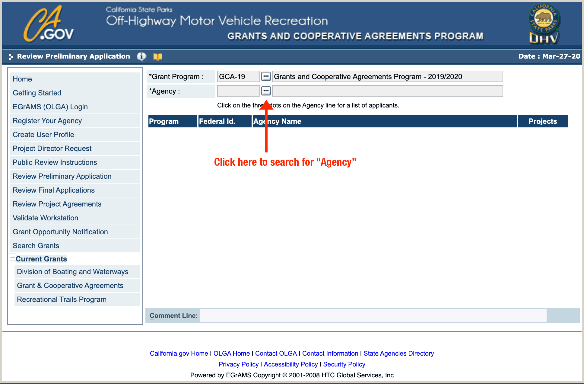
- Go to the OHV Grant Web Page
- Choose Agency
- Choose Project
then add comment
We Need Comments for Each of These Four Grants
Downieville Ground Operations
This is for trail Maintenance on 80 miles of trail on the Downieville Trail System and CAL-Ida.
- Go to this page and click on the “•••” button after “Agency”
- Choose Agency: type in “Sierra Buttes Trail Stewardship”
- Choose Project: “Ground Operations”
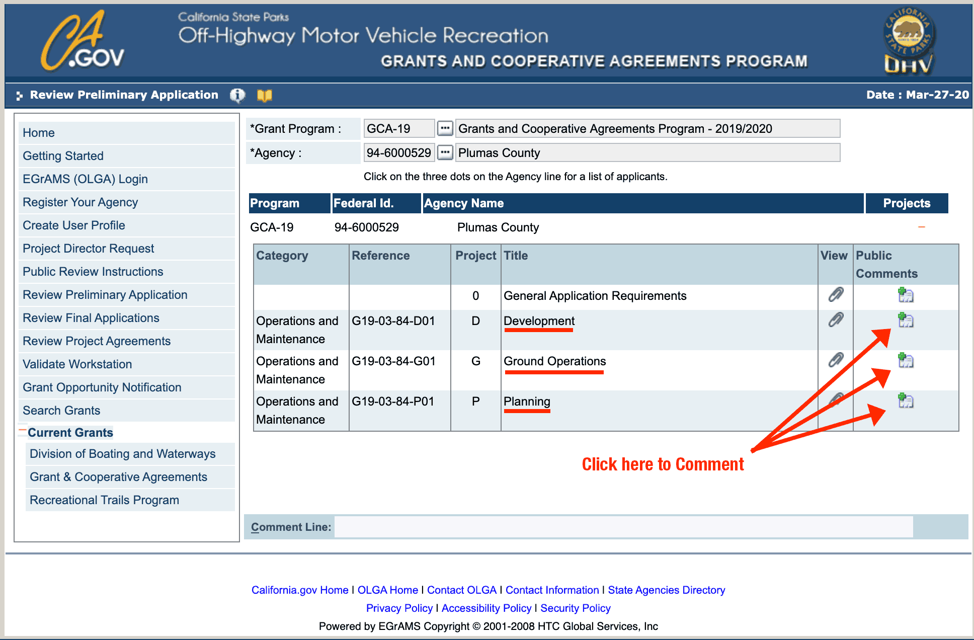
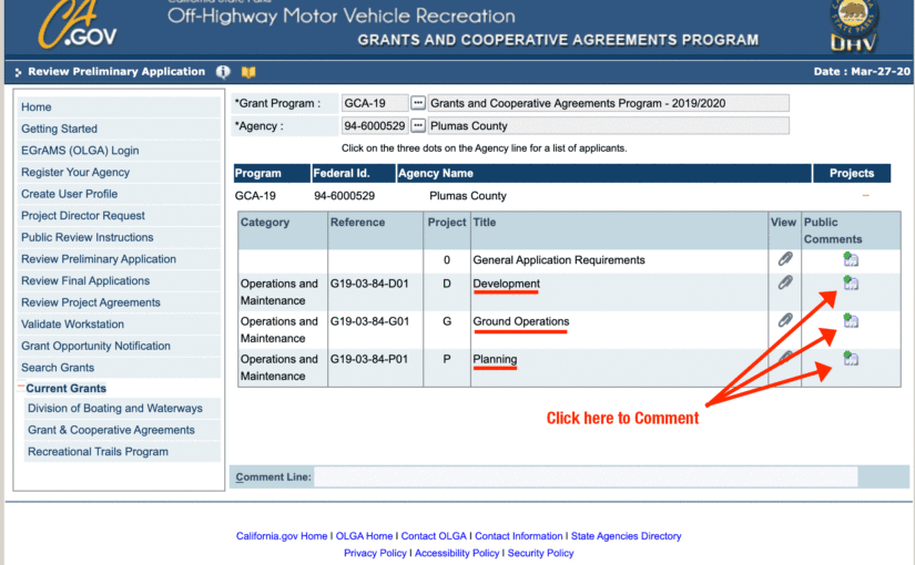
Plumas County Ground Operation
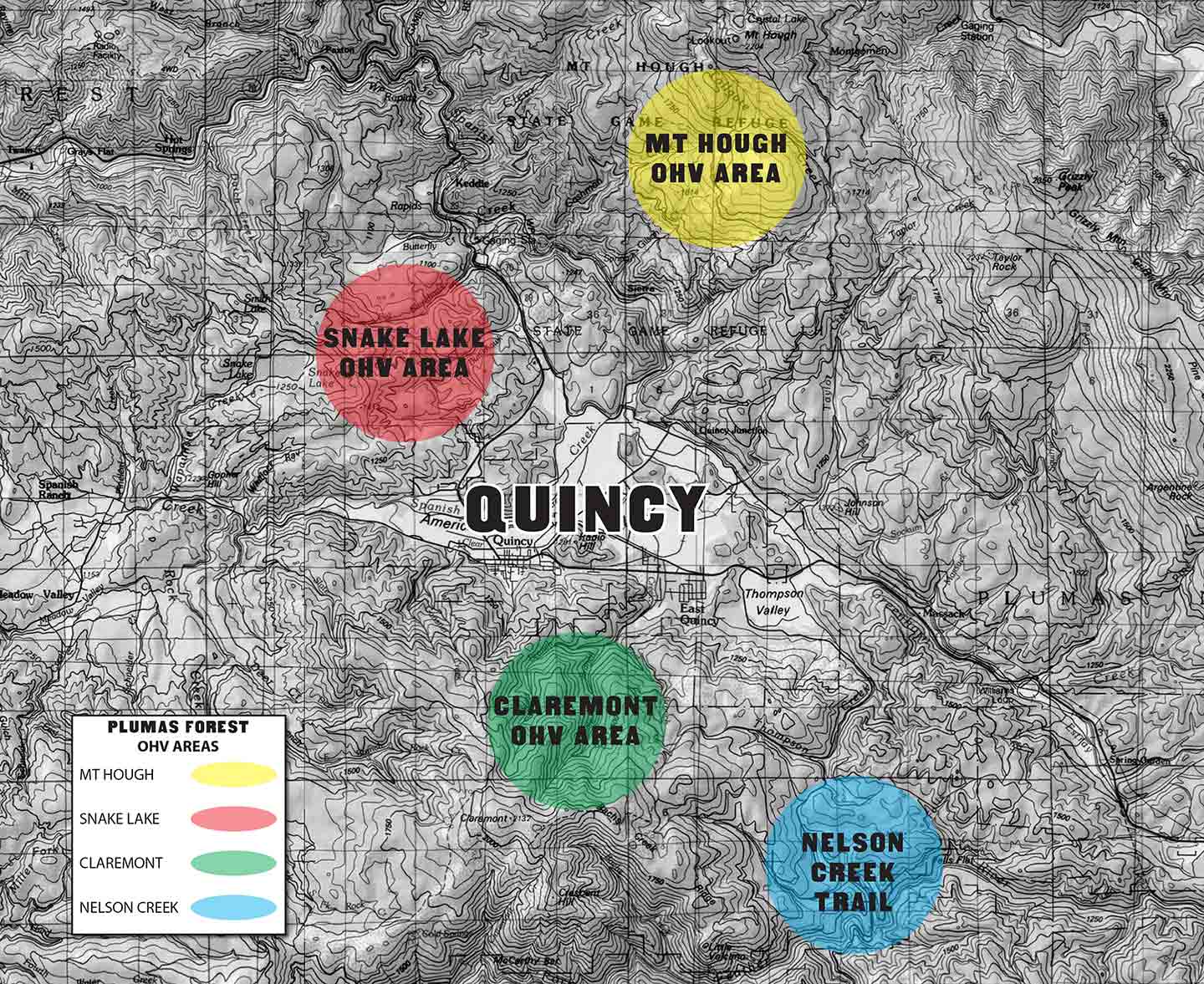
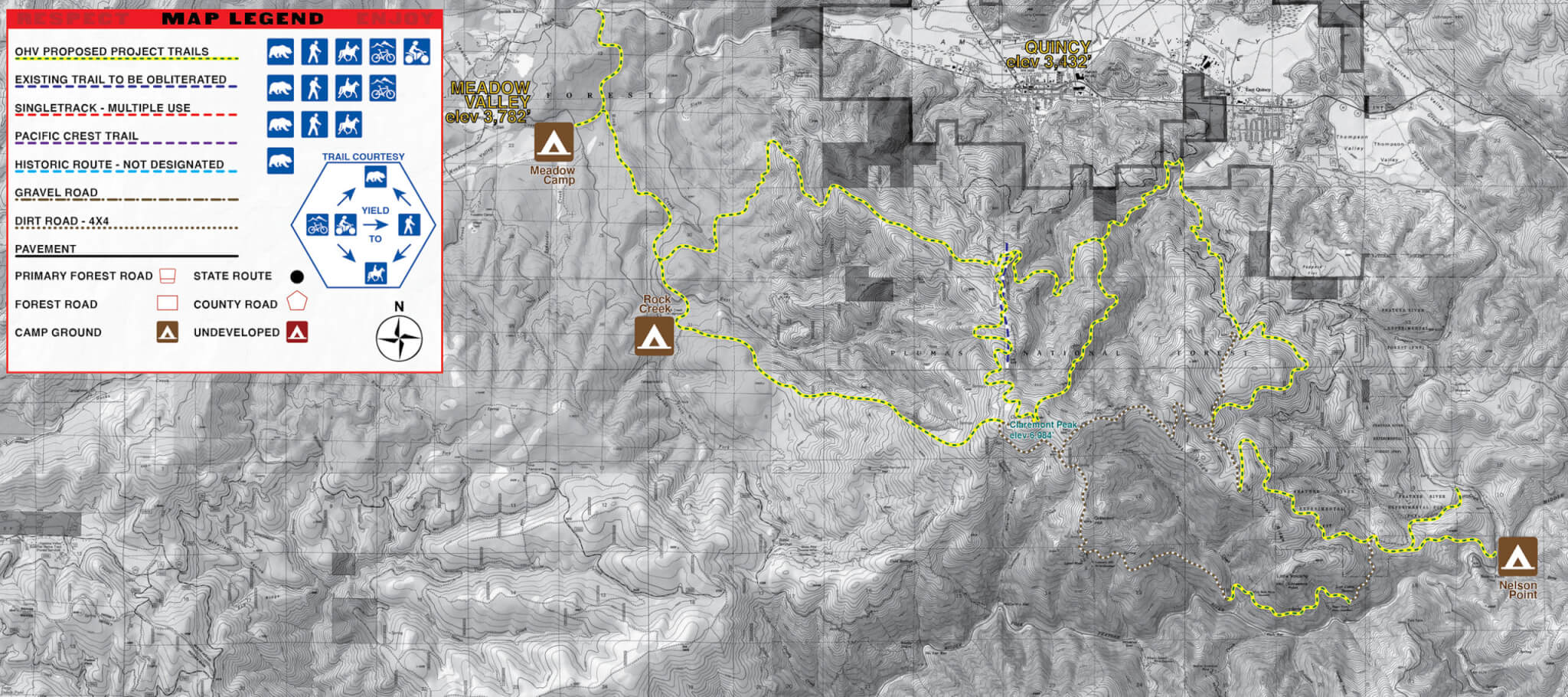
This is for trail maintenance on 70+ miles of trail including Mt Hough Trail System, Claremont, Nelson Creek, Mt Fillmore.
- Go to this page and click on the “•••” button after “Agency”
- Choose Agency: type in “Plumas County” and select “Plumas County” (not “Public Works”, “Search & Rescue”, nor “Sheriff’s Office”)
- Choose Project: “Ground Operations“
Mt Hough Phase II Development
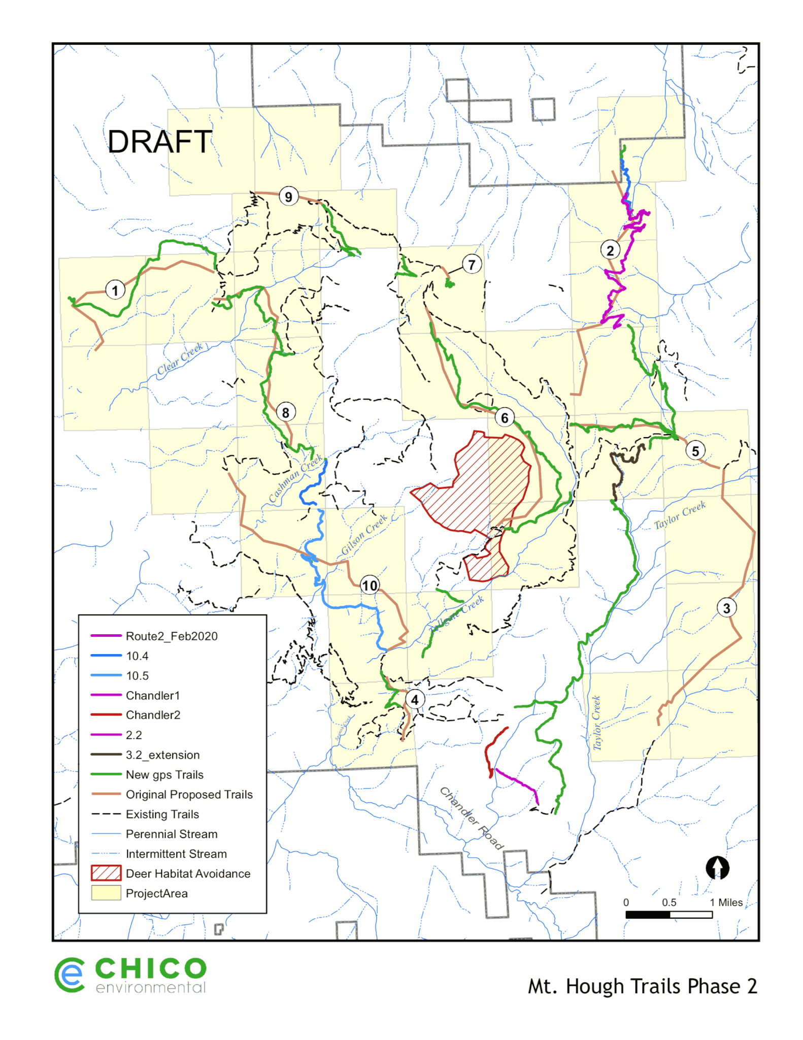
This is for construction of 30+ miles of new trail on the Mt Hough Trail System.
- Go to this page and click on the “•••” button after “Agency”
- Choose Agency: type in “Plumas County” and select “Plumas County” (not “Public Works”, “Search & Rescue”, nor “Sheriff’s Office”)
- Choose Project: “Development“
Claremont Planning
This is for environmental planning and analysis on adding potential 40 miles to the Claremont zone connecting existing campgrounds and trails.
- Go to this page and click on the “•••” button after “Agency”
- Choose Agency: “Plumas County” and select “Plumas County” (not “Public Works”, “Search & Rescue”, nor “Sheriff’s Office”)
- Choose Project: “Planning“
Visual Guide on How to Comment
Step 1:
Step 2:

Step 3: